
Expeditions and Groups
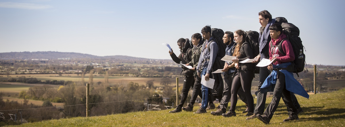
Exmoor National Park is a popular destination for all sorts of group activities, including Duke of Edinburgh’s Award expeditions and scout groups. Our wide variety of landscapes, large areas of open access land and excellent rights of way network make it an ideal place for multi-day trips.
Explore our Walking Section for some great info on our favourite routes. There are many accessible tracks on Exmoor; so a route that involves all people can easily be found, whatever their level of mobility. For more information have a look at our Accessible Exmoor Page.
Please note we endeavour to ensure the information below is accurate and up to date, but accept no liability for any loss, damage or inconvenience that arise from use of the information laid out below. Any reliance you place on the information is therefore strictly at your own risk.
Exmoor is a fantastic location for a Duke of Edinburgh’s Award expedition as there are only a few places where you are further than 4km from a road, which allows easy access to your groups when remotely supervising. Our ‘wilderness’ area is not as extensive as other National Parks so it’s worth considering whether you can plan a challenging 4-day Gold expedition without groups leaving the area or walking along the same paths. Bear in mind, though, there is such a thing as an ‘Exmoor mile’; we specialise in deep, plentiful river valleys so a mile on the map may take you longer than you think!
Over 480km of our rights of way network are bridleways making us an ideal place to take part in horse riding or mountain biking expeditions.
There are many quiet roads on Exmoor, and two of the sustrans cycle routes (51 and 3) run west/east across the national park, making cycle touring an option. Bear in mind that our roads have some steep climbs and descents!
Inland kayaking is not an option for multi day trips; only the river Barle (grade2-3) and East Lyn (grade5-6) have short sections that are useable and supported by the owners.
The Exmoor coastline is spectacular, so makes an incredible place for sea kayaking.However, the extreme tidal range and other factors means this should only be considered by very competent and well supported groups.
For expedition members with additional needs, there are many routes and tracks on Exmoor that would be suitable for off road mobility scooters. Some resources to help in planning are below.
Landowner permission is required to camp overnight anywhere on Exmoor. Exmoor National Park Authority has two ‘wild’ sites where it allows youth groups to stay; one in Hawkcombe woods near Porlock, and in the grounds of our education centre to the west of Simonsbath. These must be booked in advance and are subject to availability; please email pinkery@exmoor-nationalpark.gov.uk for more details.
There are many campsites and bunkhouses on Exmoor, however not all take group bookings and some are only open for part of the season. Visit Exmoor keeps a list of potential accommodation. Other websites, such a Pitchup and campsites.co.uk show other available accommodation – if in doubt call your preferred site for additional information.
Here are the most commonly used by expeditions. It is important to check well in advance that a group can be accommodated, and that the details below are still correct.
| Name | Location | Tel No | Notes | |
| Burrowhayes Farm Campsite | Porlock | 01643 862463 | info@burrowhayes.co.uk | Does not accept expedition groups in high season |
| Lynmouth Holiday Retreat | Barbrook | 01752 842318 | ||
| Blindwell bunkhouse & camping | Twitchen | 01598 740246 | delbridge.carol@googlemail.com | |
| Cloud Farm Campsite | Oare | CloudFarmCampsite@nationaltrust.org.uk | ||
| Doone Valley Campsite | Oare | 01598 741267 | caroline.burge@btconnect.com | Does not accept groups on Bank Holidays. Groups MUST be booked in and confirmed before arrival |
| Exe valley Caravan and Camping Site | Bridgetown | 01643 851432 | info@exevalleycamping.co.uk | |
| Halse Farm Campsite | Winsford | 01643 851 259 | info@halsefarm.co.uk | |
| Moor Wood Campsite | North Hill | 07517 224209 | ||
| Sparkhayes Farm Campsite | Porlock | 07721 045123 | sparkhayes@hotmail.com | |
| Westermill Farm Campsite | Exford | 01643 831 238 | info@westermill.com | |
| Wimbleball lake Campsite | Brompton Regis | 01398 371460 | wimbleball@swlakestrust.org.uk | |
| Lowtrow Cross Inn Campsite | Upton | 01398 371199 | lowtrowreception@gmail.com | No under 17’s |
| Northcombe Camping Barns | Dulverton | 01398 323602 | sallyeharvey17@gmail.com |
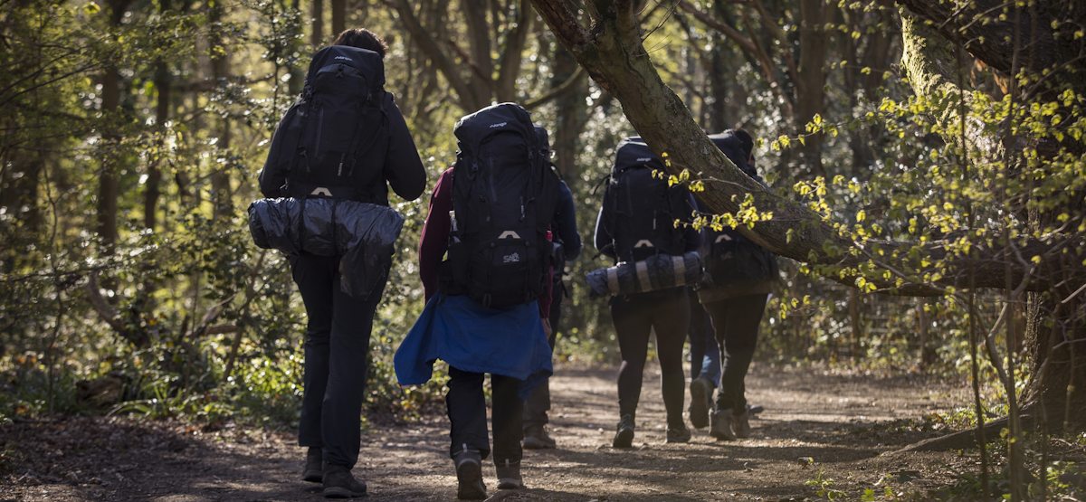
There are plenty of ways to get to your accommodation as Exmoor has an excellent network of nearly 1000km of public rights of way, and another 340km of permitted paths (these are paths a landowner allows people to use).
Please take care to ensure your activity is allowed on your route; for instance, bicycles and horses are not allowed on public footpaths by right. More details are in our Out and About Essentials Section.
We have a map of the available routes to help with your planning, which is updated regularly. Please remember that paths are subject to change and closure (especially permitted ones), so always check our Path News Page for a list of legal closures, and obey any signage that you come across when on Exmoor. Storm and flood damage can also seriously impact our path network; often large sections can be closed for weeks after severe weather. A good option, if you use twitter, is to subscribe to our rights of way feed.
Open Access
About 25% of the land on Exmoor is classed as ‘Open Access’. This means you can walk where you want on these areas. These areas are shown on Ordnance Survey maps as a yellow wash, and further information can be found on our open access page. The Ramblers Association also has some excellent information. Only walking is allowed on access land; however it is quite possible that a bridleway crosses the land thus allowing horse riding or bicycles along that route.
Access land can be subject to closures and some other restrictions. Current closures can be viewed at the Natural England Access map; access closures on Exmoor are rare though. The most likely reason for closure would be in the event of an extreme wildfire risk in the summer.
A National Park is for everyone; and seeing groups out and about genuinely pleases so many people. You can’t go too far wrong if you follow the countryside code, but there are some extra points to note when on Exmoor:
- Always shut the gate! It is very easy for a group to get spread out. The first person through leaves it for the next, and by the time the last passes through they don’t think to shut it. If a farmer wants a gate to remain open then it will be firmly tied in place. This is the number one cause of complaints from farmers – if in doubt close it and make sure the latch is firmly in place.
- Please make sure all litter goes home, or to the nearest bin. If that bin is full, take it with you to another. Do not rely on attaching notes to indicate you have passed a checkpoint; it is not a reliable way of communicating and can leave a bad impression with other people.
- Do not block gateways or junctions with vehicles while looking/waiting for groups. Exmoor specialises in narrow lanes and farmers rely on being able to swing straight into fields with no delay. It is tempting to park at road junctions where there is more space, but that room is often needed for trailers to make the corner. Please take particular care along the road between Malmsmead and Oareford, as many groups cross this road, so is a popular place for checkpoints:
For General information including how to limit the risks from ticks - visit the Out and About Essentials Page
- Exmoor is a safe National Park to visit, but there are few particular things you might want to bear in mind while planning your route. This is by no means a comprehensive list of hazards, and it is the responsibility of those organising the expeditions to ensure risk assessments are carried out and followed.
- There are public rights of way marked crossing the river Barle between Withypool and Tarr Steps. Most of these are at fords that are not safe to cross unless on horse back. Even then you would only attempt them in low water conditions. Please refer to the map below for guidance; generally, if you stick to the eastern bank of the river following the Two Moors Way, you will be fine. However, when the river rises in storm conditions it can make some sections more difficult to traverse safely.
- There is no safe way of walking along the shingle ridge from Porlock to Bossington. Follow the Coast Path diversion inland. Be aware that some of the paths are tidal and can be underwater for periods of the day.
- There are many parts of the coast path; particularly to the west of Lynmouth, that are adjacent to very large cliffs. Particular care should be taken on the footpath to the west of Foreland Point in high winds as it is extremely exposed.
- Near Lynton, the Sillery Sands footpath is no longer safe as the ladder and steps have been washed away preventing easy access to the beach.
- If in open country, groups should bear in mind that unexploded shells from WW2 training and mineshafts are potential, if rare, hazards.
- We hope you enjoy your expedition on Exmoor; there is loads more information to be found on our website and through our National Park Centres. If you see a National Park Ranger when out, give them a wave!